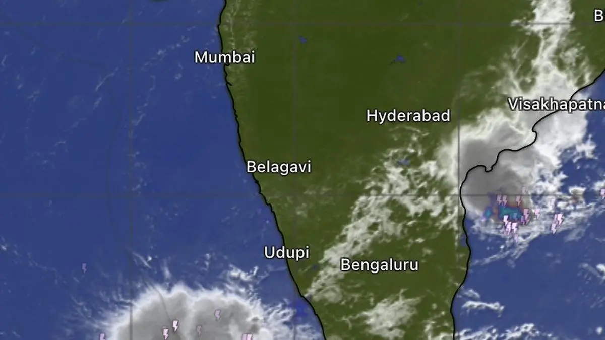

Satellite imagery on Tuesday morning showed clouds and rain bands lining up along Mumbai; Konkan; Goa; Coastal Karnataka; and parts of Kerala, signalling a renewed phase of the monsoon along the west coast, according to the India Meteorological Department (IMD). The European Centre for Medium-Range Weather Forecasts (ECMWF) indicates rainfall for the coast through the ongoing fortnight ending July 6, after which rainfall may weaken significantly and could even shut down over parts of the region during the remainder of July — normally the rainiest monsoon month.
Central India sowing window
The outlook remains cautious for rain-deficient Central India. The current week (June 22-29) and the week that follows (June 29-July 6) appear to offer the best opportunity for sowing, while prospects during the week of July 13-20 are less encouraging, the IMD reported. The weather agency expects isolated to scattered rainfall over Chhattisgarh, Vidarbha and West Madhya Pradesh for six days, and over East Madhya Pradesh for four days. Deficits in parts of the region have exceeded 60 per cent, leaving farmers uncertain about sowing decisions.
Low-pressure area and rainfall drivers
The expected two-week wet spell is likely to be driven initially by a cyclonic circulation developing over eastern India, followed by a better-organised low-pressure area over the north-west Bay of Bengal off the Odisha-West Bengal coast, the IMD noted. The strength and track of these systems will determine the extent of rainfall over the core agricultural belt. The weather agency has also warned of pre-monsoon-like thunderstorms, lightning and gusty winds over Chhattisgarh, East and West Madhya Pradesh, and Vidarbha for the next four days.
July rainfall projections
For the fourth week of July, the ECMWF projects near-normal rainfall across much of North-West, East, and Central India, including parts of Punjab, all of Haryana, Chandigarh, Delhi, Uttar Pradesh, Bihar, West Bengal, the North-Eastern States, Jharkhand, Chhattisgarh, Odisha, East Madhya Pradesh, Vidarbha, and northern Andhra Pradesh. Below-normal rainfall is indicated over Rajasthan, Gujarat and Saurashtra, West Madhya Pradesh, Mumbai-Konkan-Goa, Madhya Maharashtra, Marathwada, Telangana, Karnataka, and northern Tamil Nadu. In contrast, Kerala and adjoining parts of southern and central Tamil Nadu are likely to receive near-normal rainfall.
| Region | Week 4 July Rainfall Outlook |
|---|---|
| Punjab, Haryana, Delhi, UP, Bihar, West Bengal, NE states, Jharkhand, Chhattisgarh, Odisha, East MP, Vidarbha, northern AP | Near-normal |
| Rajasthan, Gujarat & Saurashtra, West MP, Mumbai-Konkan-Goa, Madhya Maharashtra, Marathwada, Telangana, Karnataka, northern TN | Below-normal |
| Kerala, southern/central TN | Near-normal |
Southern India thunderstorm activity
Meanwhile on Tuesday morning, clusters of heavy thunderstorms and dense cloud cover were seen over the Bay off Bhubaneswar and Brahmapur in Odisha along the east coast, extending southward in weaker form towards Visakhapatnam and Vijayawada in Andhra Pradesh. Scattered clouding was observed over parts of Tamil Nadu, Karnataka, Telangana, and Rayalaseema, indicating favourable conditions for intermittent rainfall and thunderstorm activity. Isolated to fairly widespread rainfall is likely over Tamil Nadu, Puducherry and Karaikal, interior Karnataka, Rayalaseema, and Telangana for a few days, the IMD said.
For agricultural commodity markets, the two-week sowing window is critical for kharif crops including soybean, cotton, pulses, and coarse cereals in Central India. Any further delay in planting due to inadequate rainfall could reduce acreage and ultimately impact harvest volumes later this year. Traders and procurement teams will closely monitor weekly rainfall updates and the evolution of the low-pressure system, as well as the ECMWF's July outlook, to gauge supply risks for the upcoming season.
Sources: