Apple Maps is poised for a major enhancement with its Flyover feature, set to debut in the upcoming iOS 27. This upgrade promises to deliver more detailed 3D city views, leveraging advanced technologies like Vision Intelligence and Gaussian Splatting.
The Technology Behind the Upgrade
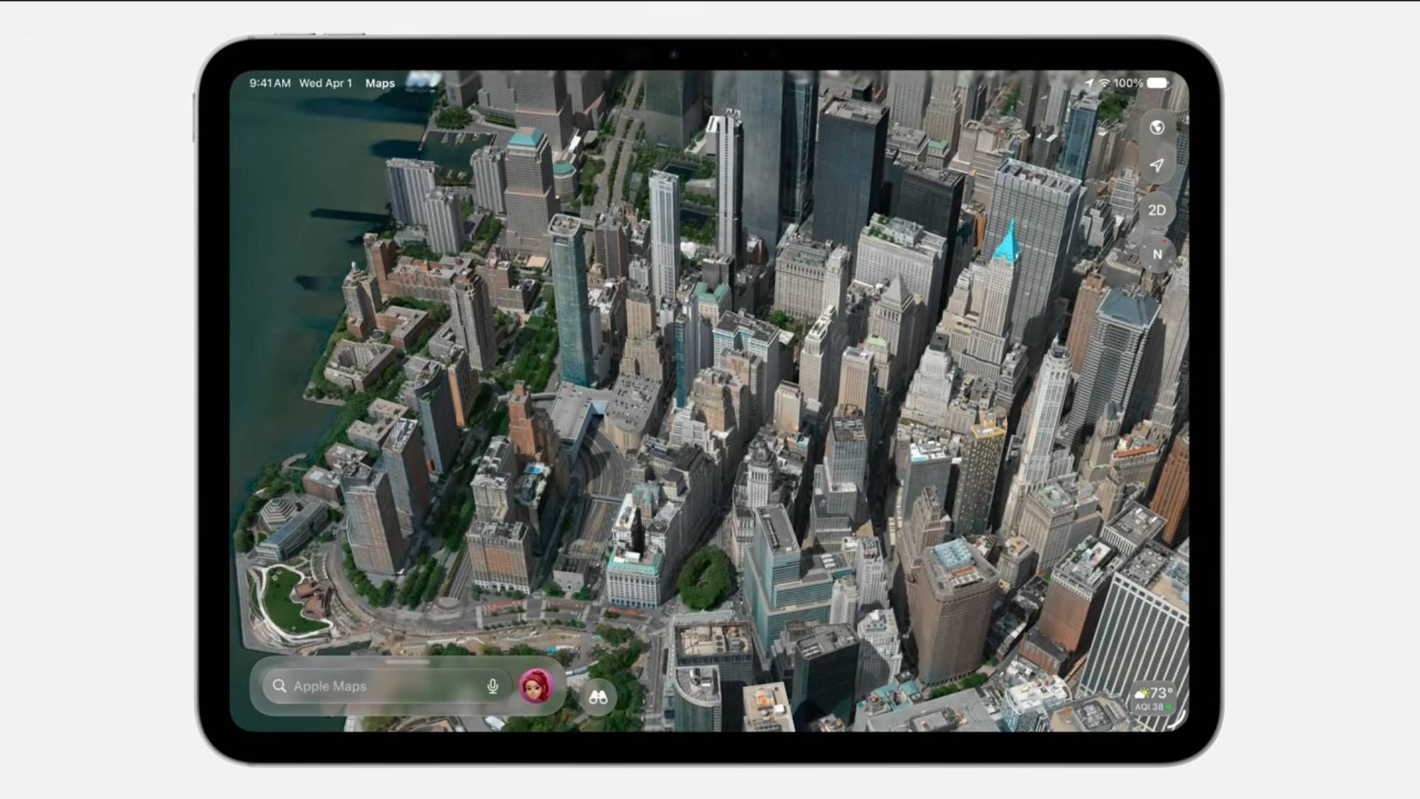
The Flyover feature in Apple Maps will now use a combination of aerial imagery and Apple's proprietary Vision Intelligence models to create highly detailed 3D models of over 350 cities worldwide. According to TechRadar, the integration of Gaussian Splatting—a technique that constructs 3D frameworks from video footage—marks a significant shift from traditional photogrammetry methods used by competitors like Google Maps.
From beautiful architectural details to the shapes of individual trees, to the way light reflects off the glass of skyscrapers, you’ll see cities around the world like never before.
Competitive Edge Over Google Maps
The adoption of Gaussian Splatting could give Apple a competitive advantage over Google Maps, which currently relies on photogrammetry. This new technique addresses common issues such as distorted imagery, often referred to as "broccoli trees" and "melted powerlines," by providing more accurate ground-level details.
User Reactions and Rollout
The announcement of this upgrade has sparked discussions among users, particularly on platforms like Reddit. Some users have noted a "weird rollout," where certain cities revert to lower-quality images while others receive the new enhancements. Cities like Las Vegas, London, Berlin, and Barcelona have reportedly been upgraded, while others like San Antonio, Houston, Dallas, and Phoenix have not yet received the update.
Implications for Enterprise Users
For enterprise users, particularly those in logistics and supply chain management, the enhanced 3D mapping capabilities could offer improved route planning and urban analysis. The detailed visual data can aid in infrastructure assessment and strategic planning, potentially reducing operational costs and improving efficiency.
| Feature | Apple Maps | Google Maps |
|---|---|---|
| 3D Modeling Technique | Gaussian Splatting | Photogrammetry |
| Detail Level | High | Moderate |
| Cities Covered | 350+ | Extensive |
As the iOS 27 rollout approaches, the anticipation builds for how these technological advancements will reshape digital mapping and urban visualization.
Sources: